The Magnificent Mont Pt II – Normandy, France
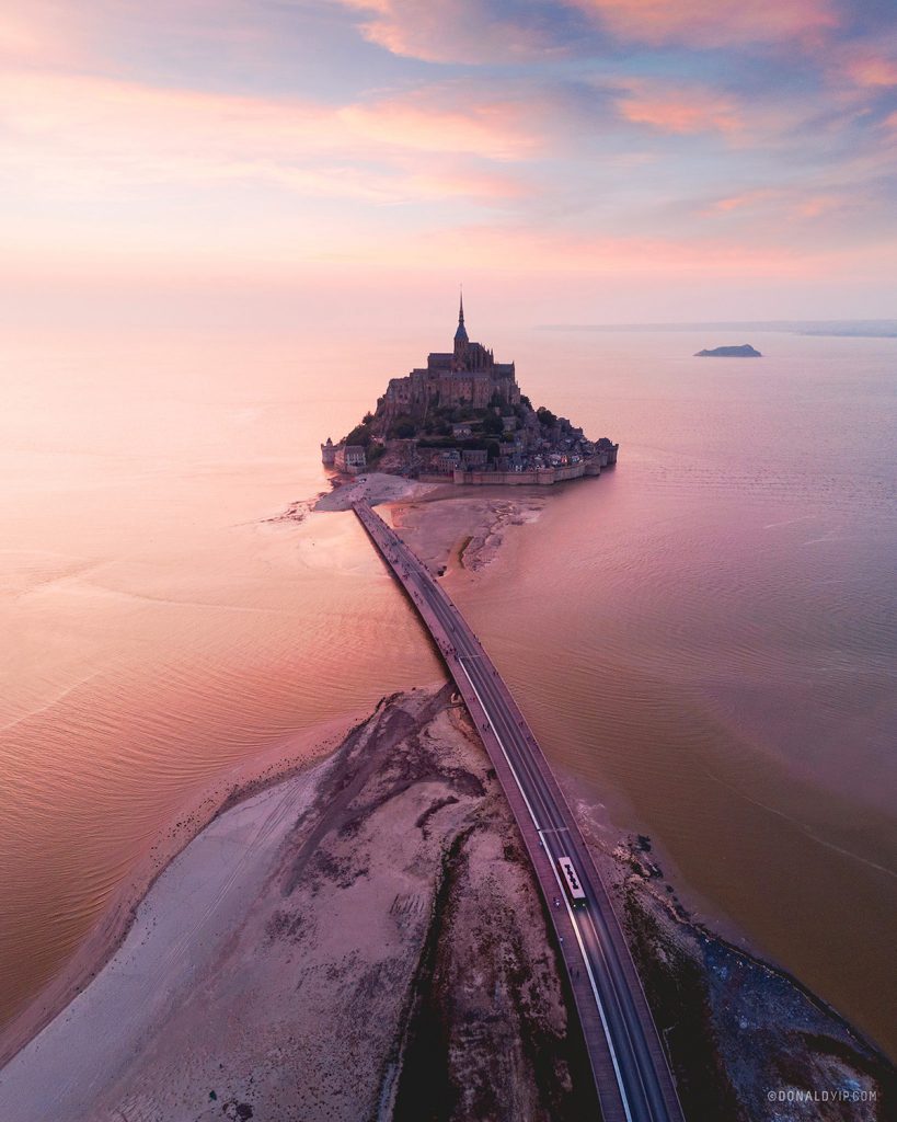
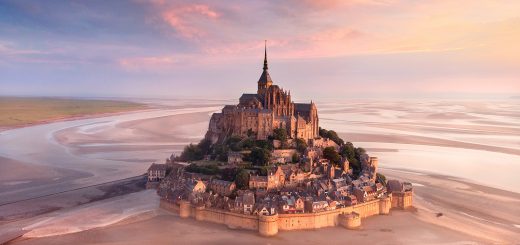
A single road traverses tidal sands to an island, where the distinctive silhouette of Mont Saint Michel stands above a flooded landscape at dusk.
It’s amazing that such a fairy-tale place like this exists in our world! A small town dominated by the spectacular monastery, with unobstructed views literally thousands of kilometeres around it.
The road you see in this image is an elevated causeway, built on stilts which allows water to flow freely around it. Previous to this, the island was linked by a large, wide road built on reclaimed land.
The small figures and bus on the causeway give you an idea of how vast and open this landscape is, and how epic the Mont Saint Michel stands at the end of it. The shuttle is free and runs throughout most of the day, up until midnight (which you may need in the peak periods, since sunset at the height of summer is 10:30PM).
This shot is a vertical panorama, and comprises of 4 images in landscape mode, stitched together in Adobe Lightroom to form one large, high resolution vertical image.
This format allows me to provide a sweeping view, beginning with an almost top-down angle at 90 degrees, up to the horizon level.
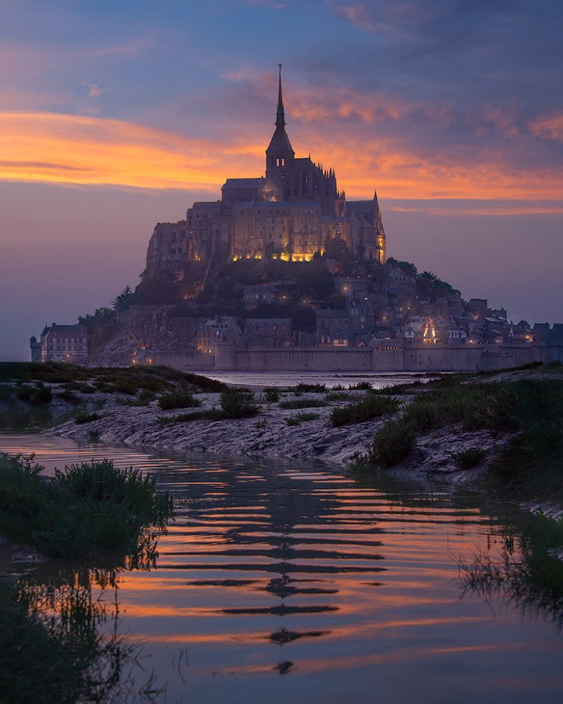
I also had my DSLR shooting on a bracketed intervalometer, whilst I was simultaneously capturing images from the air. The result from my DSLR is below.
Notes: Overall, I like to think that I’m very considerate when flying. I distinctly avoid people and buildings, and always try to fly at sunrise. Before the creation of this image, I spoke to the local gendarmerie (police) in town and acquired verbal permission, and the DJI Zone Map only lists this area as a warning (Cat D Airspace for drones over 20kg).
TECHNICAL INFO
DJI Mavic Air
ISO 100, 3 shot vertical panorama, Auto
Pano stitched in Lightroom using Photo Merge functionality
Sunset 10:08PM
Location – Mont Saint Michel, Normandy, France